If you live in the great Washington DC area, Charlottesville area, or
are an avid hiker on the East Coast, you've probably heard of Old Rag
Mountain in Shenandoah National Park. Hiking the Old Rag Mountain is a
right of passage for anyone in DC who considers themselves the
outdoors-man and for many University of Virginia students. The Old Rag
hike is one that has become an annual tradition for my fiance and
myself.
 |
| View from an Old Rag 'false summit' |
I've completed the 9 mile loop twice. Once was in October and the other was in August. In October we experienced freezing rain. Make sure to dress appropriately. Rain jackets and gloves were needed. At the rock scramble, the October weather added two major difficulties. First, the rocks were very slippery. Good shoes are another must have as well as friends who are willing to help each other over obstacles. The other difficulty caused by the October weather was the temperature. The cool rain made the stone on the mountain very cold, and for most of the rock scramble it is important to use your hands to help you over obstacles leaving us with very cold and very sore fingers. The August hike was much more enjoyable. Its recommended to get an early start, which combined with the shady trail and summit breeze made climbing very enjoyable.
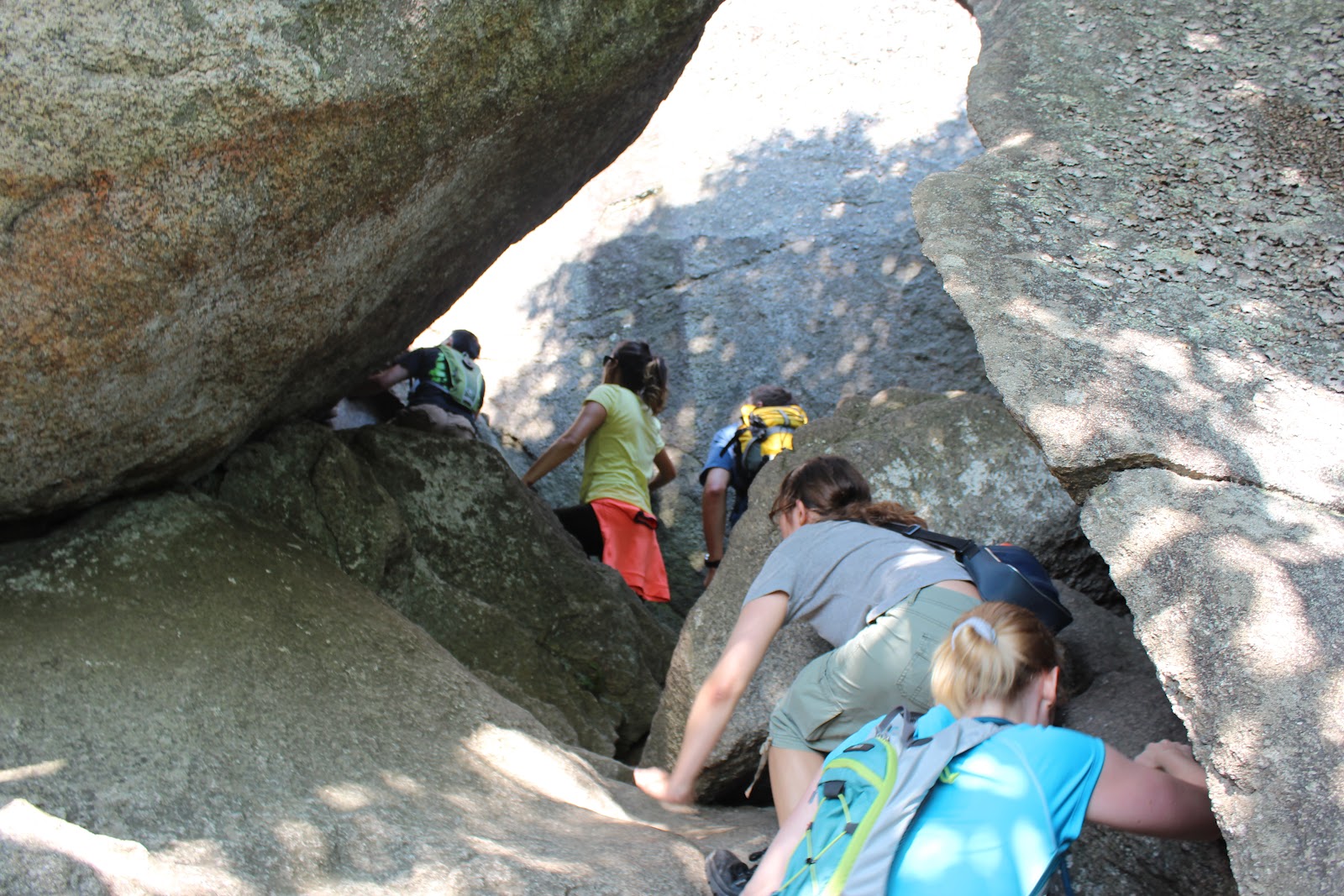 |
| Be prepared for wet, cold, or hot rocks. You will touch them! |
The trail itself begins slowly enough with a consistent elevation gain through a forest. After another half mile you will find the trail elevation gains increasing quicker as a series of switchbacks start to climb the mountain. When you reach the 2 mile mark the rock scramble begins. The mile long rock scramble involves climbing up boulders and then lowering yourself into several crevice as deep at 12 feet.

 |
Climbing down crevices.
 
|
As you get closer to the summit there are several 'false summits', but remember to stop and enjoy the view there too. After the scrambling the travel gets easier as you get to the true summit. Once you know the true summit because there is a sign there marking the distances back to the parking lot. The distance you've traveled so far is 3.8miles. The sign indicates that the remaining distance to travel is 5.2 miles to the parking lot, with other indicators at .4 miles, 1 mile, and 1.9 miles.
 |
| View from the Summit |
If you are interested in hiking Old Rag be sure to leave yourself enough time. I'd say 8 hours to plus travel time. Maybe more if you choose to stop for dinner on the way home. I also highly recommend this website for more information.
Summary:
I highly recommend this as a great teenage and adult daytrip from the Washington DC are. Make sure to come prepared with water, food, and appropriate dress for the weather. Leave yourself a full day for this hike, but remember to take your time and enjoy the views as you go!
No comments:
Post a Comment